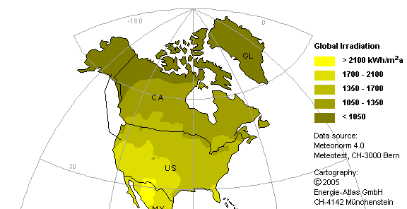
The map shows the geographical distribution of the solar radiation
incident on the earth's surface each year. Depending on the shape of the sun's
apparent path (solar ecliptic), the amount of radiation decreases towards the
polar regions.
The maximum values occur slightly south or north of the equator;
their location is also determined by the incidence and type of cloud cover.
On
the land area worldwide, this results in a solar radiation of at least 200,000,000 TWh
per year. (For comparison: 9 billion people, each requiring 2,000 watts, would
have a total annual energy demand of 160,000 TWh.)