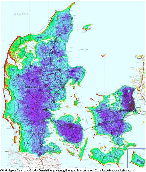
This map of Danish wind speeds takes local terrain (speed up effects)
and roughness into account. It shows a detailed picture of wind conditions. We
can clearly see that West and Southwest are the prevailing wind direction in Denmark,
since West and Southwest facing coastal sites have by far the highest energy content
of the wind (the red and yellow areas).
The map is actually
a very high resolution map, where the area of the whole country (44,000 km 2
area) was divided into 1.1 million squares 200 by 200 m each (220 by 220
yards), and the mean wind speed was calculated for each square.
http://www.windpower.org/en/tour/wres/dkmap.htm